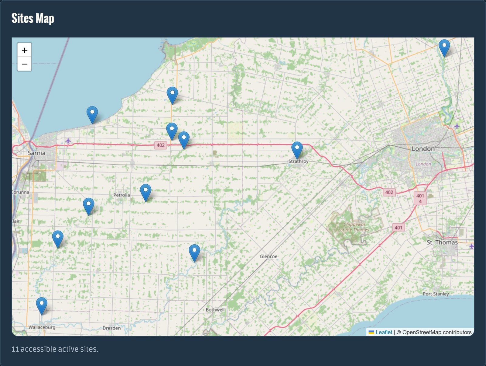
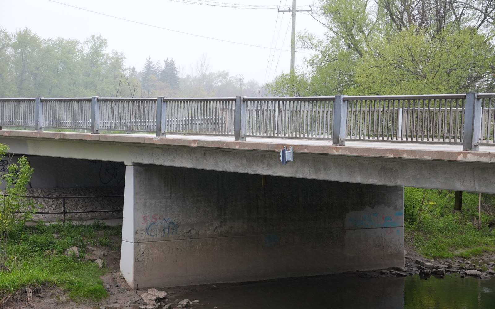
Environmental intelligence for critical infrastructure

Know what is changing before it becomes urgent.

Radiant Aerial helps organizations observe, understand, and respond to changing environmental and infrastructure conditions.

By connecting field instrumentation, communications infrastructure, and operational dashboards, we transform remote observations into actionable information for infrastructure management, environmental stewardship, and operational decision-making.

When conditions change

The first advantage is knowing.

Water levels rise.
Weather shifts.
Infrastructure ages.
Risk accumulates.

The quality of every decision depends on the quality of the information available. Radiant Aerial provides environmental monitoring systems that deliver reliable observations from the field, helping organizations improve awareness, reduce uncertainty, and respond with confidence.

Field observation becomes operational awareness.

Radiant Aerial connects remote installations in the field with organization-wide visibility in the office. Every observation contributes to a clearer understanding of changing conditions.

Radiant Aerial field monitoring installation mounted beneath a bridge
Field Observation

Where information begins

Sensors are installed at the locations that matter most, continuously collecting observations from waterways, infrastructure, and environmental systems.

The objective is simple: understand what is happening at the source.

Radiant Aerial active monitoring sites map
Operational Awareness

Where information becomes action

Site maps, dashboards, alerts, and historical records transform individual observations into a broader operational picture.

Teams gain the visibility required to identify trends, prioritize resources, and make better-informed decisions.

Monitoring capabilities

Practical systems for observing the environmental and infrastructure conditions that affect operations, planning, and response.

Water

Water Monitoring

Continuous observation of water levels and changing conditions to support flood awareness, drainage systems, culvert monitoring, infrastructure planning, and environmental stewardship.

Weather

Weather Intelligence

Localized environmental sensing that captures site-specific conditions, providing context beyond regional forecasts and generalized reporting.

Infrastructure

Infrastructure Monitoring

Practical monitoring solutions that help organizations understand site conditions, document risk, prioritize resources, and maintain critical assets.

Designed for reliability

Built for the long, quiet middle between site visits.

Environmental monitoring is valuable when it continues to work quietly, consistently, and predictably.

Radiant Aerial systems are engineered around dependable data collection, secure communications, and long-term operational sustainability. Every component, from field instrumentation to cloud infrastructure, is designed to provide trustworthy information when it matters most.

Autonomous Field Monitoring

Low-maintenance field systems designed to wake, measure, record, transmit, and return to sleep across remote and challenging environments.

Secure Data Collection

Purpose-built ingestion, validation, storage, and presentation workflows that preserve the integrity of every observation.

Role-Based Information Access

Secure dashboards that ensure the right information reaches the right people at the right time.

Scalable Architecture

Designed to support a single monitoring site, a regional deployment, or a distributed sensor network using the same operational foundation.

Built for organizations that cannot afford blind spots.

Radiant Aerial supports teams responsible for infrastructure, environmental conditions, public safety, field operations, and long-term asset stewardship.

Conservation Authorities
Municipal Infrastructure
Stormwater Management
Transportation Corridors
Environmental Monitoring
Asset Management
Emergency Response
Research and Pilot Programs

Turn field uncertainty into operational awareness.

Radiant Aerial helps organizations transform remote observations into actionable information through reliable instrumentation, communications, and data management systems.

Whether supporting a pilot deployment or a growing monitoring network, our focus remains the same:

Dependable information.
Clearer decisions.
Fewer surprises.
Start a Conversation